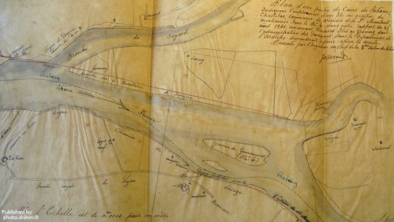
Original title (in French): Plan d'une partie du cours du Rhône indiquant l'emplacement d'une île au quartier du Chastelas, communes de Viviers et de St Montant. English title: Map of part of the Rhône river locating an island in the Chastelas district and the towns of Viviers and St Montant.
Auteur : Josserand
Lat : 44.439529, Lon : 4.686608
Pour plus d'informations vous pouvez consulter la page de l'image sur photo.driihm.fr -> Lien