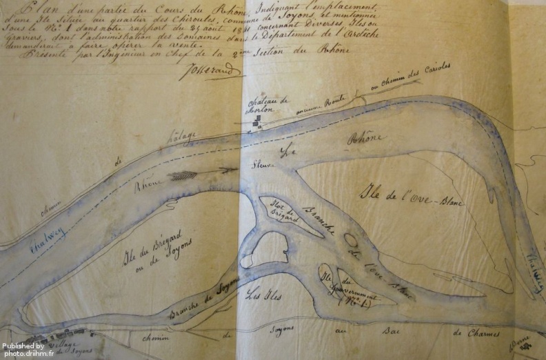
Original title (in French): Plan d'une partie du cours du Rhône indiquant l'emplacement d'une île située aux quartiers des Chiroules, commune de Soyons. English title: Map of part of the Rhône river indicating the location of an island in the Chiroules district, town of Soyons.
Auteur : Josserand
Lat : 44.874556, Lon : 4.860652
Pour plus d'informations vous pouvez consulter la page de l'image sur photo.driihm.fr -> Lien